
Thank you for supporting this site ❤️
Make a donation
Make a donation
Gear up for your next adventure:
As an Amazon Associate, this site earns from qualifying purchases at no extra cost to you.
Mosqueroles topographic map
Click on the map to display elevation.
Thank you for supporting this site ❤️
Make a donation
Make a donation
Gear up for your next adventure:
As an Amazon Associate, this site earns from qualifying purchases at no extra cost to you.
About this map
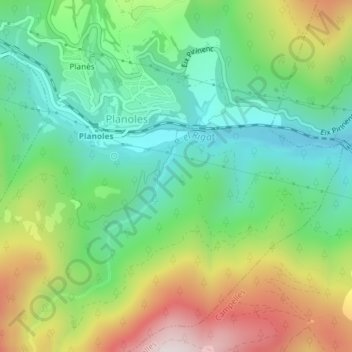
Name: Mosqueroles topographic map, elevation, terrain.
Location: Mosqueroles, Planoles, Ripollés, Gerona, Cataluña, 17535, España (42.30043 2.09811 42.32043 2.11811)
Average elevation: 4,124 ft
Minimum elevation: 3,301 ft
Maximum elevation: 5,564 ft
Thank you for supporting this site ❤️
Make a donation
Make a donation
Gear up for your next adventure:
As an Amazon Associate, this site earns from qualifying purchases at no extra cost to you.