
Thank you for supporting this site ❤️
Make a donation
Make a donation
Gear up for your next adventure:
As an Amazon Associate, this site earns from qualifying purchases at no extra cost to you.
Hayes topographic map
Click on the map to display elevation.
Thank you for supporting this site ❤️
Make a donation
Make a donation
Gear up for your next adventure:
As an Amazon Associate, this site earns from qualifying purchases at no extra cost to you.
About this map
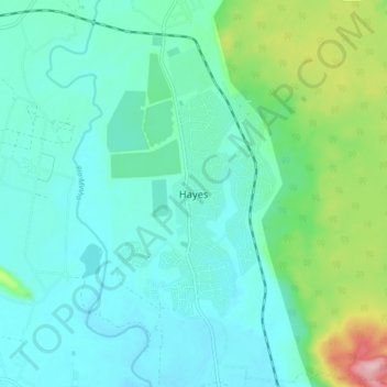
Name: Hayes topographic map, elevation, terrain.
Location: Hayes, Clarendon, Middlesex County, JAMAICA, Jamaica (17.83511 -77.28007 17.91511 -77.20007)
Average elevation: 184 ft
Minimum elevation: 33 ft
Maximum elevation: 771 ft
Thank you for supporting this site ❤️
Make a donation
Make a donation
Gear up for your next adventure:
As an Amazon Associate, this site earns from qualifying purchases at no extra cost to you.