
Thank you for supporting this site ❤️
Make a donation
Make a donation
Gear up for your next adventure:
As an Amazon Associate, this site earns from qualifying purchases at no extra cost to you.
Borda do Campo topographic map
Click on the map to display elevation.
Thank you for supporting this site ❤️
Make a donation
Make a donation
Gear up for your next adventure:
As an Amazon Associate, this site earns from qualifying purchases at no extra cost to you.
About this map
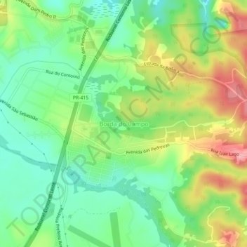
Name: Borda do Campo topographic map, elevation, terrain.
Average elevation: 3,012 ft
Minimum elevation: 2,854 ft
Maximum elevation: 3,251 ft
Thank you for supporting this site ❤️
Make a donation
Make a donation
Gear up for your next adventure:
As an Amazon Associate, this site earns from qualifying purchases at no extra cost to you.
Other topographic maps
Click on a map to view its topography, its elevation and its terrain.
Parque Estadual Serra da Baitaca
Brasil > Paraná > Região Metropolitana de Curitiba > Quatro Barras > Borda do Campo
Average elevation: 3,120 ft