
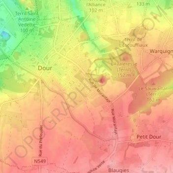
Cité Chevalière topographic map
Interactive map
Click on the map to display elevation.
About this map
Name: Cité Chevalière topographic map, elevation, terrain.
Location: Cité Chevalière, Dour, Mons, Hainaut, Wallonie, 7370, Belgique (50.37205 3.77375 50.41205 3.81375)
Average elevation: 341 ft
Minimum elevation: 115 ft
Maximum elevation: 459 ft