
Thank you for supporting this site ❤️
Make a donation
Make a donation
Gear up for your next adventure:
As an Amazon Associate, this site earns from qualifying purchases at no extra cost to you.
Tadjenanet topographic map
Click on the map to display elevation.
Thank you for supporting this site ❤️
Make a donation
Make a donation
Gear up for your next adventure:
As an Amazon Associate, this site earns from qualifying purchases at no extra cost to you.
About this map
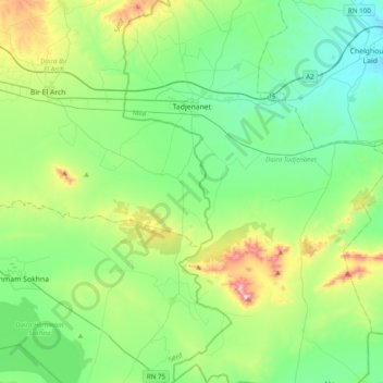
Name: Tadjenanet topographic map, elevation, terrain.
Location: Tadjenanet, Tadjenanet District, Mila, Algeria (35.89061 5.91506 36.20567 6.10639)
Average elevation: 2,995 ft
Minimum elevation: 2,480 ft
Maximum elevation: 4,564 ft
Thank you for supporting this site ❤️
Make a donation
Make a donation
Gear up for your next adventure:
As an Amazon Associate, this site earns from qualifying purchases at no extra cost to you.