
Thank you for supporting this site ❤️
Make a donation
Make a donation
Gear up for your next adventure:
As an Amazon Associate, this site earns from qualifying purchases at no extra cost to you.
Huben topographic map
Click on the map to display elevation.
Thank you for supporting this site ❤️
Make a donation
Make a donation
Gear up for your next adventure:
As an Amazon Associate, this site earns from qualifying purchases at no extra cost to you.
About this map
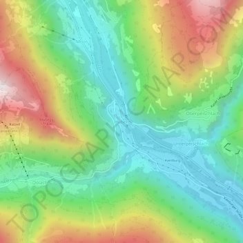
Name: Huben topographic map, elevation, terrain.
Location: Huben, Matrei in Osttirol, Bezirk Lienz, Tyrol, 9971, Austria (46.91352 12.55493 46.95352 12.59493)
Average elevation: 3,904 ft
Minimum elevation: 2,533 ft
Maximum elevation: 6,276 ft
Thank you for supporting this site ❤️
Make a donation
Make a donation
Gear up for your next adventure:
As an Amazon Associate, this site earns from qualifying purchases at no extra cost to you.