Geolocate

Bushnell topographic map

Click on the map to display elevation.

About this map

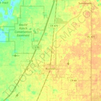
Name: Bushnell topographic map, elevation, terrain.

Location: Bushnell, Sumter County, Florida, United States (28.62479 -82.15383 28.74883 -82.07550)

Average elevation: 72 ft

Minimum elevation: 10 ft

Maximum elevation: 112 ft

Sumter County trails, hiking, mountain biking, running and outdoor activities

Other topographic maps

Click on a map to view its topography, its elevation and its terrain.

Oxford

United States > Florida > Sumter County

Average elevation: 95 ft

Sumterville

United States > Florida > Sumter County

Average elevation: 75 ft

Sumterville

United States > Florida > Sumter County

Average elevation: 75 ft

Gear up for your next adventure:

🦶Hiking Gaiters - Keep debris and water out of your boots
📷Action Camera - Capture your outdoor adventures in HD
🧦Hiking Socks - Comfortable socks to prevent blisters on long hikes
🧴Hand Sanitizer - Keep hands clean while hiking
🪶Wildlife Field Guides - Learn animal tracking and species ID

As an Amazon Associate, this site earns from qualifying purchases at no extra cost to you.