
Shinn topographic map
Click on the map to display elevation.
About this map
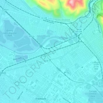
Name: Shinn topographic map, elevation, terrain.
Average elevation: 92 ft
Minimum elevation: 7 ft
Maximum elevation: 823 ft
Alameda County trails, hiking, mountain biking, running and outdoor activities
Other topographic maps
Click on a map to view its topography, its elevation and its terrain.
Coyote Hills Regional Park
United States > California > Alameda County > Fremont
Average elevation: 16 ft
Mission Peak Regional Preserve
United States > California > Alameda County > Fremont
Average elevation: 1,056 ft