
Thank you for supporting this site ❤️
Make a donation
Make a donation
Gear up for your next adventure:
As an Amazon Associate, this site earns from qualifying purchases at no extra cost to you.
Bougaa topographic map
Click on the map to display elevation.
Thank you for supporting this site ❤️
Make a donation
Make a donation
Gear up for your next adventure:
As an Amazon Associate, this site earns from qualifying purchases at no extra cost to you.
About this map
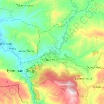
Name: Bougaa topographic map, elevation, terrain.
Location: Bougaa, Bougaa District, Setif, 19003, Algeria (36.29028 5.06127 36.38883 5.16745)
Average elevation: 3,110 ft
Minimum elevation: 1,975 ft
Maximum elevation: 5,279 ft
Thank you for supporting this site ❤️
Make a donation
Make a donation
Gear up for your next adventure:
As an Amazon Associate, this site earns from qualifying purchases at no extra cost to you.