
Hallingdal topographic map
Interactive map
Click on the map to display elevation.
About this map
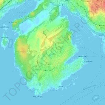
Name: Hallingdal topographic map, elevation, terrain.
Location: Hallingdal, Frogner, Oslo, 0287, Norway (59.89588 10.67353 59.91588 10.69353)
Average elevation: 30 ft
Minimum elevation: -7 ft
Maximum elevation: 154 ft
Other topographic maps
Click on a map to view its topography, its elevation and its terrain.