
Make a donation
Gear up for your next adventure:
As an Amazon Associate, this site earns from qualifying purchases at no extra cost to you.
Spirit island topographic map
Click on the map to display elevation.
Make a donation
Gear up for your next adventure:
As an Amazon Associate, this site earns from qualifying purchases at no extra cost to you.
About this map
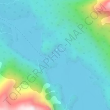
Name: Spirit island topographic map, elevation, terrain.
Average elevation: 5,945 ft
Minimum elevation: 5,489 ft
Maximum elevation: 7,966 ft
Make a donation
Gear up for your next adventure:
As an Amazon Associate, this site earns from qualifying purchases at no extra cost to you.
Other topographic maps
Click on a map to view its topography, its elevation and its terrain.
Columbia Icefield
Canada > Alberta > Improvement District No. 12 > Area A (Kicking Horse/Kinbasket Lake)
Columbia Icefield has an alpine climate (Köppen: ETf), because the weather station is located at an altitude of 1,981.20 m (6,500 ft). The average annual temperature is −2.1 °C (28.2 °F). The month of July is the warmest with an average temperature of 9.1 °C (48.38 °F).
Average elevation: 8,196 ft
Mount Columbia
Canada > Alberta > Improvement District No. 12 > Area A (Kicking Horse/Kinbasket Lake)
Average elevation: 9,327 ft
Make a donation
Gear up for your next adventure:
As an Amazon Associate, this site earns from qualifying purchases at no extra cost to you.