
Thank you for supporting this site ❤️
Make a donation
Make a donation
Gear up for your next adventure:
As an Amazon Associate, this site earns from qualifying purchases at no extra cost to you.
Dansön topographic map
Click on the map to display elevation.
Thank you for supporting this site ❤️
Make a donation
Make a donation
Gear up for your next adventure:
As an Amazon Associate, this site earns from qualifying purchases at no extra cost to you.
About this map
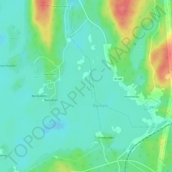
Name: Dansön topographic map, elevation, terrain.
Location: Dansön, Rämsbyn, Ludvika kommun, Dalarna County, Sweden (60.30688 15.20543 60.30737 15.20590)
Average elevation: 840 ft
Minimum elevation: 778 ft
Maximum elevation: 994 ft
Thank you for supporting this site ❤️
Make a donation
Make a donation
Gear up for your next adventure:
As an Amazon Associate, this site earns from qualifying purchases at no extra cost to you.