Geolocate

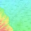
Vršani topographic map

Click on the map to display elevation.

About this map

Name: Vršani topographic map, elevation, terrain.

Location: Vršani, City of Bijeljina, Republika Srpska, 76323, Bosnia and Herzegovina (44.81235 19.00408 44.85235 19.04408)

Average elevation: 299 ft

Minimum elevation: 262 ft

Maximum elevation: 338 ft

Other topographic maps

Click on a map to view its topography, its elevation and its terrain.
Gear up for your next adventure:

🪄Magnetic Compass - Accurate compass for navigation
🧭Outdoor Navigation Book - Learn advanced navigation skills
🖼️Topo Map Wall Art - Decorative topographic prints of famous peaks and regions
📶Satellite Messenger - Communication device off‑grid
📖Nature Tracking Books - Learn to track wildlife and terrain

As an Amazon Associate, this site earns from qualifying purchases at no extra cost to you.