
Morra De Sanctis topographic map
Interactive map
Click on the map to display elevation.
About this map
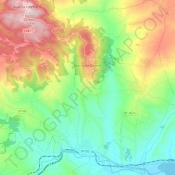
Name: Morra De Sanctis topographic map, elevation, terrain.
Location: Morra De Sanctis, Avellino, Campania, Italia (40.88284 15.23377 40.95651 15.29518)
Average elevation: 2,142 ft
Minimum elevation: 1,404 ft
Maximum elevation: 3,337 ft
Other topographic maps
Click on a map to view its topography, its elevation and its terrain.