Unger topographic map
Interactive map
Click on the map to display elevation.
About this map
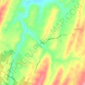
Name: Unger topographic map, elevation, terrain.
Location: Unger, Morgan County, West Virginia, United States (39.41676 -78.27389 39.45676 -78.23389)
Average elevation: 961 ft
Minimum elevation: 768 ft
Maximum elevation: 1,165 ft
Other topographic maps
Click on a map to view its topography, its elevation and its terrain.
Oakland
United States > West Virginia > Morgan County
Oakland, Morgan County, West Virginia, United States
Average elevation: 879 ft
Berkeley Springs
United States > West Virginia > Morgan County > Berkeley Springs
Berkeley Springs, Bath (Berkeley Springs), Morgan County, West Virginia, 25411, United States
Average elevation: 751 ft
Bath (Berkeley Springs)
United States > West Virginia > Morgan County
Bath (Berkeley Springs), Morgan County, West Virginia, United States
Average elevation: 761 ft
Paw Paw
United States > West Virginia > Morgan County
Paw Paw, Morgan County, West Virginia, 25434, United States
Average elevation: 643 ft