Geolocate

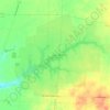
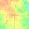
Feesburg topographic map

Click on the map to display elevation.

About this map

Name: Feesburg topographic map, elevation, terrain.

Location: Feesburg, Lewis Township, Brown County, Ohio, 45119, United States (38.85840 -84.01887 38.89840 -83.97887)

Average elevation: 919 ft

Minimum elevation: 846 ft

Maximum elevation: 991 ft

Brown County trails, hiking, mountain biking, running and outdoor activities

Other topographic maps

Click on a map to view its topography, its elevation and its terrain.
Russellville

United States > Ohio > Brown County

Average elevation: 945 ft

Lake Waynoka

United States > Ohio > Brown County

Average elevation: 1,024 ft

Ripley

United States > Ohio > Brown County

Average elevation: 676 ft

Georgetown

United States > Ohio > Brown County

Average elevation: 892 ft

Sardinia

United States > Ohio > Brown County

Average elevation: 955 ft

Pleasant Township

United States > Ohio > Brown County

Average elevation: 853 ft

Huntington Township

United States > Ohio > Brown County

Average elevation: 768 ft

Russellville

United States > Ohio > Brown County

Average elevation: 945 ft

Gear up for your next adventure:

🧢Outdoor Hiking Hat - Sun protection hat for outdoor explorers
🗺️NatGeo Topo Maps - High-quality waterproof printed topographic maps of US Parks
🥾Men's Hiking Boots - Durable, waterproof footwear for rugged terrain and steep inclines
🏕️Tent Footprint - Protect your tent base from wear
🪶Compact Camp Shovel - Folding shovel for campsite tasks

As an Amazon Associate, this site earns from qualifying purchases at no extra cost to you.