Geolocate

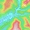
Valquières topographic map

Click on the map to display elevation.

About this map

Name: Valquières topographic map, elevation, terrain.

Location: Valquières, Lunas-les-Châteaux, Béziers, Hérault, Occitanie, France métropolitaine, 34650, France (43.64746 3.21445 43.68746 3.25445)

Average elevation: 1,575 ft

Minimum elevation: 863 ft

Maximum elevation: 2,293 ft

Other topographic maps

Click on a map to view its topography, its elevation and its terrain.
Lunas

France > Occitanie > Hérault > Lunas-les-Châteaux

Average elevation: 1,480 ft

Château de Lunas

France > Occitanie > Hérault > Lunas-les-Châteaux > Lunas

Average elevation: 1,260 ft

Gear up for your next adventure:

🪑Ultralight Camp Chairs - Portable seating for resting after a long day of mapping
🧥Men's Rain Shells - Premium waterproof and breathable jackets for mountain weather
🥾Hiking Shoes - Durable and comfortable shoes for trail hiking
🪑Portable Camp Table - Compact table for campsite meals
👟Men's Trail Runners - Lightweight footwear for fast-paced exploration and light hiking

As an Amazon Associate, this site earns from qualifying purchases at no extra cost to you.