
Natters topographic map
Interactive map
Click on the map to display elevation.
About this map
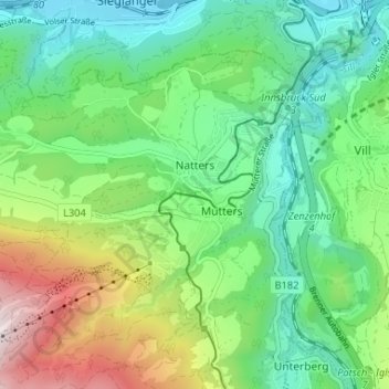
Name: Natters topographic map, elevation, terrain.
Location: Natters, Bezirk Innsbruck-Land, 6161, Austria (47.21381 11.32958 47.24683 11.39494)
Average elevation: 2,802 ft
Minimum elevation: 1,890 ft
Maximum elevation: 4,826 ft
Other topographic maps
Click on a map to view its topography, its elevation and its terrain.
Seefeld in Tirol
Austria > Bezirk Innsbruck-Land
Seefeld in Tirol, Bezirk Innsbruck-Land, 6100, Austria
Average elevation: 4,275 ft