
Thank you for supporting this site ❤️
Make a donation
Make a donation
Gear up for your next adventure:
As an Amazon Associate, this site earns from qualifying purchases at no extra cost to you.
Hühnerberg topographic map
Click on the map to display elevation.
Thank you for supporting this site ❤️
Make a donation
Make a donation
Gear up for your next adventure:
As an Amazon Associate, this site earns from qualifying purchases at no extra cost to you.
About this map
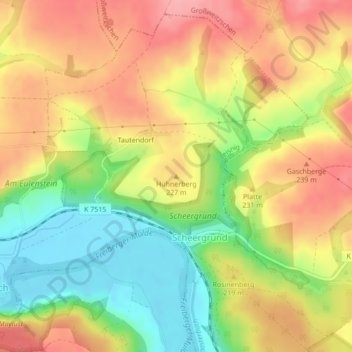
Name: Hühnerberg topographic map, elevation, terrain.
Location: Hühnerberg, Leisnig, Mittelsachsen, Saxony, Germany (51.16104 13.00813 51.16114 13.00823)
Average elevation: 686 ft
Minimum elevation: 499 ft
Maximum elevation: 846 ft
Thank you for supporting this site ❤️
Make a donation
Make a donation
Gear up for your next adventure:
As an Amazon Associate, this site earns from qualifying purchases at no extra cost to you.