
Taft Heights topographic map
Click on the map to display elevation.
Taft Heights
Taft Heights (formerly, Boust City) is a census-designated place (CDP) in Kern County, California, United States. Taft Heights is located 1 mile (1.6 km) west-southwest of Taft, at an elevation of 1,178 feet (359 m). The population was 1,949 at the 2010 census, up from 1,865 at the 2000 census.
About this map
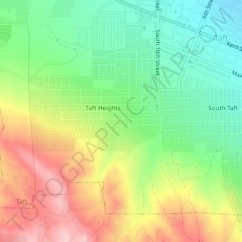
Name: Taft Heights topographic map, elevation, terrain.
Location: Taft Heights, Taft, Kern County, California, United States (35.12960 -119.47860 35.13679 -119.46470)
Average elevation: 1,207 ft
Minimum elevation: 899 ft
Maximum elevation: 1,617 ft
Kern County trails, hiking, mountain biking, running and outdoor activities