Geolocate

Melezet topographic map

Click on the map to display elevation.

About this map

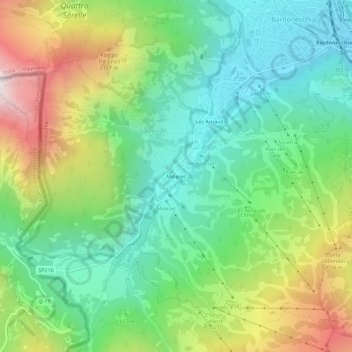
Name: Melezet topographic map, elevation, terrain.

Location: Melezet, Bardonecchia, Torino, Piemonte, 10052, Italia (45.04044 6.66432 45.08044 6.70432)

Average elevation: 5,541 ft

Minimum elevation: 4,098 ft

Maximum elevation: 8,287 ft

Gear up for your next adventure:

🦟Ultrasonic Repellers - Create a bug-free zone at your camp or rest stop
🥇GPS Hiking Watch - Multi‑sport GPS watch with navigation and trail tracking
🥩Freeze-Dried Meals - Nutritious and lightweight food for remote expeditions
📦Dry Bags Set - Waterproof storage for electronics and clothes
📦Gear Storage Bags - Organize and protect outdoor equipment

As an Amazon Associate, this site earns from qualifying purchases at no extra cost to you.