
Thank you for supporting this site ❤️
Make a donation
Make a donation
Gear up for your next adventure:
As an Amazon Associate, this site earns from qualifying purchases at no extra cost to you.
Kimla topographic map
Click on the map to display elevation.
Thank you for supporting this site ❤️
Make a donation
Make a donation
Gear up for your next adventure:
As an Amazon Associate, this site earns from qualifying purchases at no extra cost to you.
About this map
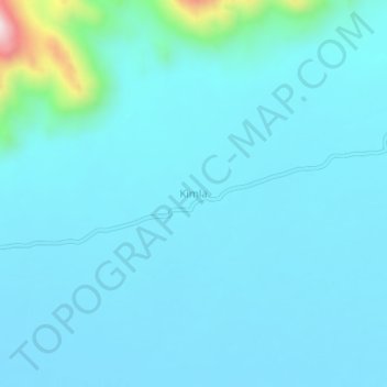
Name: Kimla topographic map, elevation, terrain.
Location: Kimla, Um Rawaba, North Kordofan State, Sudan (12.35505 30.64181 12.39505 30.68181)
Average elevation: 1,929 ft
Minimum elevation: 1,739 ft
Maximum elevation: 3,711 ft
Thank you for supporting this site ❤️
Make a donation
Make a donation
Gear up for your next adventure:
As an Amazon Associate, this site earns from qualifying purchases at no extra cost to you.