Geolocate

Izvor topographic map

Click on the map to display elevation.

About this map

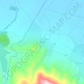
Name: Izvor topographic map, elevation, terrain.

Location: Izvor, Radomir, Pernik, 2415, Bulgaria (42.41291 22.87701 42.45291 22.91701)

Average elevation: 2,274 ft

Minimum elevation: 2,083 ft

Maximum elevation: 3,304 ft

Gear up for your next adventure:

🔋Rechargeable Batteries - Power up your outdoor devices
🎒Gear Packing Cubes - Organize your backpack efficiently
🔥Plasma Lighters - Windproof lighters that work in any weather condition
🚗GPS Dash Cams - Record your scenic drives through mountain passes and canyons
🧢Outdoor Hiking Hat - Sun protection hat for outdoor explorers

As an Amazon Associate, this site earns from qualifying purchases at no extra cost to you.