
Limon topographic map
Click on the map to display elevation.
Limon
Limon is located at 39°15′50″N 103°41′32″W / 39.26389°N 103.69222°W / 39.26389; -103.69222 at an elevation of 5,377 feet (1,639 m). Although entirely in Lincoln County, Limon is located immediately east of the Elbert County line. It lies on the north side of Big Sandy Creek, a tributary of the Arkansas River, on the eastern edge of the Colorado Piedmont region of the Great Plains, and is near the eastern end of the Palmer Divide. Located in east-central Colorado at the junction of Interstate 70, U.S. Highway 287, U.S. Highway 40, U.S. Highway 24, and State Highway 71, Limon is far from any major city or town, being 72 miles (116 km) northeast of Colorado Springs, 83 miles (134 km) southeast of Denver, and 486 miles (782 km) west of Kansas City.
About this map
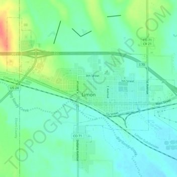
Name: Limon topographic map, elevation, terrain.
Location: Limon, Lincoln County, Colorado, 80828, United States (39.25128 -103.71509 39.28085 -103.66755)
Average elevation: 5,377 ft
Minimum elevation: 5,328 ft
Maximum elevation: 5,449 ft
Lincoln County trails, hiking, mountain biking, running and outdoor activities
Other topographic maps
Click on a map to view its topography, its elevation and its terrain.