Geolocate

Cloverdale topographic map

Click on the map to display elevation.

About this map

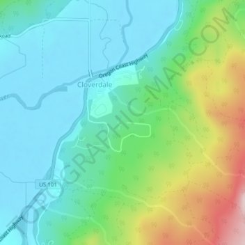
Name: Cloverdale topographic map, elevation, terrain.

Location: Cloverdale, Tillamook County, Oregon, 97112, United States (45.19295 -123.89601 45.21033 -123.87304)

Average elevation: 305 ft

Minimum elevation: -3 ft

Maximum elevation: 1,122 ft

Tillamook County trails, hiking, mountain biking, running and outdoor activities

Gear up for your next adventure:

🔥Camping Stove - Portable stove for camping and backcountry cooking
🏫Relief Map Kits - Hands-on tools for teaching landforms and elevation
🚪Portable Camp Chair - Foldable chair for comfort at camp
🏕️Tent Footprint - Protect your tent base from wear
❄️Traction Cleats - Prevent slips on icy trails during winter hikes

As an Amazon Associate, this site earns from qualifying purchases at no extra cost to you.