
Thank you for supporting this site ❤️
Make a donation
Make a donation
Gear up for your next adventure:
As an Amazon Associate, this site earns from qualifying purchases at no extra cost to you.
Michelstadt topographic map
Click on the map to display elevation.
Thank you for supporting this site ❤️
Make a donation
Make a donation
Gear up for your next adventure:
As an Amazon Associate, this site earns from qualifying purchases at no extra cost to you.
About this map
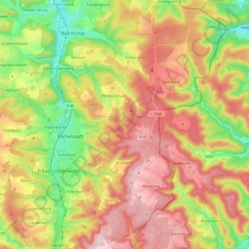
Name: Michelstadt topographic map, elevation, terrain.
Location: Michelstadt, Odenwaldkreis, Hesse, 64720, Germany (49.61901 8.91912 49.75362 9.15058)
Average elevation: 1,175 ft
Minimum elevation: 499 ft
Maximum elevation: 1,867 ft
Thank you for supporting this site ❤️
Make a donation
Make a donation
Gear up for your next adventure:
As an Amazon Associate, this site earns from qualifying purchases at no extra cost to you.