
Thank you for supporting this site ❤️
Make a donation
Make a donation
Gear up for your next adventure:
As an Amazon Associate, this site earns from qualifying purchases at no extra cost to you.
Bwisha topographic map
Click on the map to display elevation.
Thank you for supporting this site ❤️
Make a donation
Make a donation
Gear up for your next adventure:
As an Amazon Associate, this site earns from qualifying purchases at no extra cost to you.
About this map
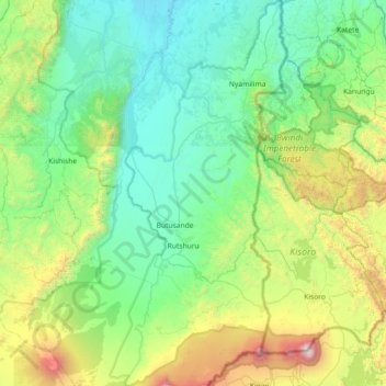
Name: Bwisha topographic map, elevation, terrain.
Location: Bwisha, Rutshuru, North Kivu, Democratic Republic of the Congo (-1.44956 29.30912 -0.72669 29.64137)
Average elevation: 5,217 ft
Minimum elevation: 3,018 ft
Maximum elevation: 13,406 ft
Thank you for supporting this site ❤️
Make a donation
Make a donation
Gear up for your next adventure:
As an Amazon Associate, this site earns from qualifying purchases at no extra cost to you.