
Make a donation
Gear up for your next adventure:
As an Amazon Associate, this site earns from qualifying purchases at no extra cost to you.
Suderwick topographic map
Click on the map to display elevation.
Make a donation
Gear up for your next adventure:
As an Amazon Associate, this site earns from qualifying purchases at no extra cost to you.
About this map
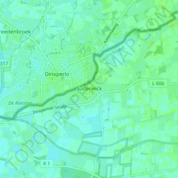
Name: Suderwick topographic map, elevation, terrain.
Average elevation: 66 ft
Minimum elevation: 52 ft
Maximum elevation: 75 ft
Make a donation
Gear up for your next adventure:
As an Amazon Associate, this site earns from qualifying purchases at no extra cost to you.
Other topographic maps
Click on a map to view its topography, its elevation and its terrain.
Liedern
Deutschland > Nordrhein-Westfalen > Kreis Borken > Bocholt > Liedern
Liedern liegt am westlichen Rand des Bocholter Stadtgebiets und war ursprünglich eine rein landwirtschaftlich geprägte Streusiedlung. Im Verlauf des 20. Jahrhunderts hat sich an der Landstraße nach Werth in Höhe Anholter Postweg ein Siedlungskern gebildet. Die ehemalige Gemeinde Liedern besaß eine Fläche…
Average elevation: 69 ft