
Thank you for supporting this site ❤️
Make a donation
Make a donation
Gear up for your next adventure:
As an Amazon Associate, this site earns from qualifying purchases at no extra cost to you.
Vilcabamba topographic map
Click on the map to display elevation.
Thank you for supporting this site ❤️
Make a donation
Make a donation
Gear up for your next adventure:
As an Amazon Associate, this site earns from qualifying purchases at no extra cost to you.
About this map
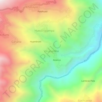
Name: Vilcabamba topographic map, elevation, terrain.
Location: Vilcabamba, Chilcayoc, Sucre, Ayacucho, Perú (-13.92075 -73.73965 -13.88075 -73.69965)
Average elevation: 9,829 ft
Minimum elevation: 7,743 ft
Maximum elevation: 12,457 ft
Thank you for supporting this site ❤️
Make a donation
Make a donation
Gear up for your next adventure:
As an Amazon Associate, this site earns from qualifying purchases at no extra cost to you.