Geolocate

Liberia topographic map

Click on the map to display elevation.

About this map

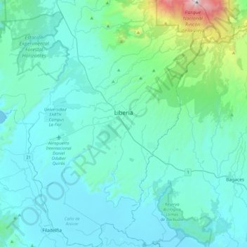
Name: Liberia topographic map, elevation, terrain.

Location: Liberia, Cantón de Liberia, Guanacaste, 50101, Costa Rica (10.41830 -85.58277 10.81273 -85.29202)

Average elevation: 669 ft

Minimum elevation: 0 ft

Maximum elevation: 6,175 ft

Gear up for your next adventure:

🧺Microfiber Travel Towels - Compact and fast-drying towels for trail use
💧Water Filtration Bottles - Safely drink from streams and lakes while exploring
📚USA Hiking Guide Books - Top trail guides and map books
🛠️Outdoor Gear Repair Kit - Essential tools to fix gear on the trail
☀️Outdoor Sunscreen - High protection sunscreen for outdoor activities

As an Amazon Associate, this site earns from qualifying purchases at no extra cost to you.