Geolocate

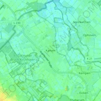
Karken topographic map

Click on the map to display elevation.

Karken

Karken ligt aan de Roer op een hoogte van 32 meter. Naast de Roer zijn er kleine beekjes als de Schaafbach, de Flutgraben en de Mühlenbach. In het noordwesten ligt de Duits-Nederlandse grens.

Wikipedia (CC-BY-SA 3.0)

About this map

Name: Karken topographic map, elevation, terrain.

Location: Karken, Heinsberg, Kreis Heinsberg, Noordrijn-Westfalen, 52525, Duitsland (51.08233 6.05906 51.12233 6.09906)

Average elevation: 112 ft

Minimum elevation: 92 ft

Maximum elevation: 154 ft

Gear up for your next adventure:

🔥Plasma Lighters - Windproof lighters that work in any weather condition
🛰️Satellite Messengers - Emergency SOS and two-way messaging for off-grid adventures
🧦Merino Wool Socks - Moisture-wicking, blister-preventing socks for long treks
🔪Outdoor Multitools - Essential survival tools for gear repair and field use
🚑Emergency Bivvies - Heat-reflective sleeping bags for survival situations

As an Amazon Associate, this site earns from qualifying purchases at no extra cost to you.