
Carlisle topographic map
Click on the map to display elevation.
About this map
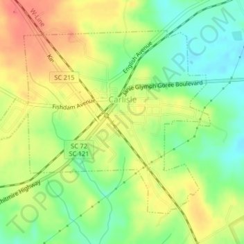
Name: Carlisle topographic map, elevation, terrain.
Location: Carlisle, Union County, South Carolina, 29031, United States (34.58028 -81.48061 34.60051 -81.45079)
Average elevation: 443 ft
Minimum elevation: 344 ft
Maximum elevation: 545 ft
Union County trails, hiking, mountain biking, running and outdoor activities
Other topographic maps
Click on a map to view its topography, its elevation and its terrain.