Geolocate

Khavda topographic map

Click on the map to display elevation.

About this map

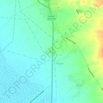
Name: Khavda topographic map, elevation, terrain.

Location: Khavda, Bhuj Taluka, Kachchh, Gujarat, 370510, India (23.80450 69.70984 23.84450 69.74984)

Average elevation: 46 ft

Minimum elevation: 10 ft

Maximum elevation: 131 ft

Other topographic maps

Click on a map to view its topography, its elevation and its terrain.

Baladiya

India > Gujarat > Bhuj Taluka

Average elevation: 509 ft

Gear up for your next adventure:

🪶Camping Sleeping Pad - Comfortable sleeping pad for backpacking
🦺Reflective Outdoor Gear - Safety gear for low‑light conditions
🪶Trail Camera - Capture wildlife on your hikes
🌲Outdoor Survival Books - Best books on survival skills
☀️Outdoor Sunscreen - High protection sunscreen for outdoor activities

As an Amazon Associate, this site earns from qualifying purchases at no extra cost to you.