
Thank you for supporting this site ❤️
Make a donation
Make a donation
Gear up for your next adventure:
As an Amazon Associate, this site earns from qualifying purchases at no extra cost to you.
Villassio topographic map
Click on the map to display elevation.
Thank you for supporting this site ❤️
Make a donation
Make a donation
Gear up for your next adventure:
As an Amazon Associate, this site earns from qualifying purchases at no extra cost to you.
About this map
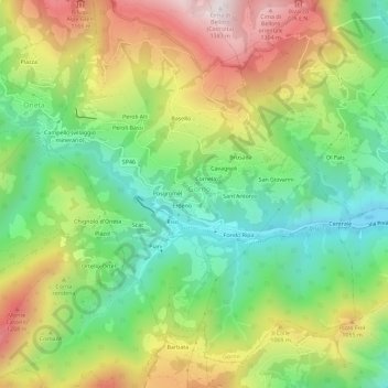
Name: Villassio topographic map, elevation, terrain.
Location: Villassio, Gorno, Bergamo, Lombardia, 24020, Italia (45.84231 9.82266 45.88231 9.86266)
Average elevation: 2,766 ft
Minimum elevation: 1,552 ft
Maximum elevation: 4,469 ft
Thank you for supporting this site ❤️
Make a donation
Make a donation
Gear up for your next adventure:
As an Amazon Associate, this site earns from qualifying purchases at no extra cost to you.