
Thank you for supporting this site ❤️
Make a donation
Make a donation
Gear up for your next adventure:
As an Amazon Associate, this site earns from qualifying purchases at no extra cost to you.
Ucedo topographic map
Click on the map to display elevation.
Thank you for supporting this site ❤️
Make a donation
Make a donation
Gear up for your next adventure:
As an Amazon Associate, this site earns from qualifying purchases at no extra cost to you.
About this map
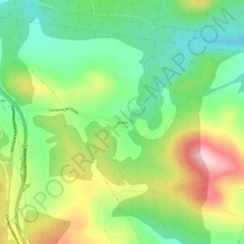
Name: Ucedo topographic map, elevation, terrain.
Location: Ucedo, Villagatón, León, Castilië en León, 24360, Spanje (42.56823 -6.21354 42.60823 -6.17354)
Average elevation: 3,806 ft
Minimum elevation: 3,445 ft
Maximum elevation: 4,367 ft
Thank you for supporting this site ❤️
Make a donation
Make a donation
Gear up for your next adventure:
As an Amazon Associate, this site earns from qualifying purchases at no extra cost to you.