
Thank you for supporting this site ❤️
Make a donation
Make a donation
Gear up for your next adventure:
As an Amazon Associate, this site earns from qualifying purchases at no extra cost to you.
Pasta topographic map
Click on the map to display elevation.
Thank you for supporting this site ❤️
Make a donation
Make a donation
Gear up for your next adventure:
As an Amazon Associate, this site earns from qualifying purchases at no extra cost to you.
About this map
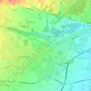
Name: Pasta topographic map, elevation, terrain.
Location: Pasta, Rivalta di Torino, Torino, Piedmont, 10043, Italy (44.99213 7.53087 45.03213 7.57087)
Average elevation: 883 ft
Minimum elevation: 823 ft
Maximum elevation: 981 ft
Thank you for supporting this site ❤️
Make a donation
Make a donation
Gear up for your next adventure:
As an Amazon Associate, this site earns from qualifying purchases at no extra cost to you.