
Thank you for supporting this site ❤️
Make a donation
Make a donation
Gear up for your next adventure:
As an Amazon Associate, this site earns from qualifying purchases at no extra cost to you.
Kreischberg topographic map
Click on the map to display elevation.
Thank you for supporting this site ❤️
Make a donation
Make a donation
Gear up for your next adventure:
As an Amazon Associate, this site earns from qualifying purchases at no extra cost to you.
About this map
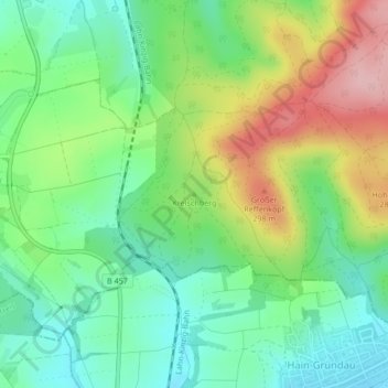
Name: Kreischberg topographic map, elevation, terrain.
Location: Kreischberg, Büdingen, Wetteraukreis, Hesse, 63654, Germany (50.25594 9.12834 50.25604 9.12844)
Average elevation: 699 ft
Minimum elevation: 486 ft
Maximum elevation: 1,063 ft
Thank you for supporting this site ❤️
Make a donation
Make a donation
Gear up for your next adventure:
As an Amazon Associate, this site earns from qualifying purchases at no extra cost to you.