Geolocate

Staffoli topographic map

Click on the map to display elevation.

About this map

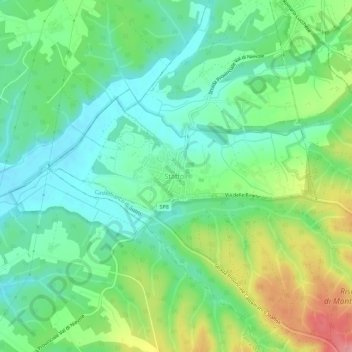
Name: Staffoli topographic map, elevation, terrain.

Location: Staffoli, Santa Croce sull'Arno, Pisa, Tuscany, 56022, Italy (43.73374 10.68223 43.77374 10.72223)

Average elevation: 121 ft

Minimum elevation: 7 ft

Maximum elevation: 344 ft

Gear up for your next adventure:

🪶Trail Camera - Capture wildlife on your hikes
🌡️Handheld Weather Meters - Measure wind, temp, and pressure for safe mountain travel
👖Convertible Hiking Pants - Versatile zip-off pants for changing altitudes and temperatures
📷Action Cameras - Rugged cameras to document your journeys across rugged terrain
🦺Reflective Outdoor Gear - Safety gear for low‑light conditions

As an Amazon Associate, this site earns from qualifying purchases at no extra cost to you.