
گوملا topographic map
Click on the map to display elevation.
About this map
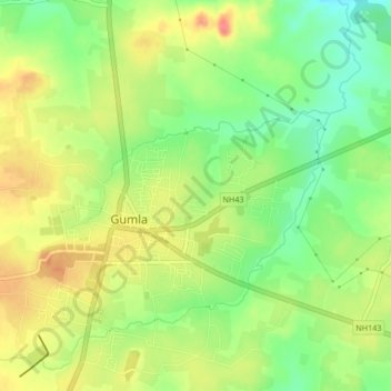
Name: گوملا topographic map, elevation, terrain.
Location: گوملا, Gumla, Gumla District, Jharkhand, 835200, India (23.03212 84.52335 23.05764 84.56498)
Average elevation: 2,100 ft
Minimum elevation: 1,995 ft
Maximum elevation: 2,208 ft