
Osterdock topographic map
Click on the map to display elevation.
About this map
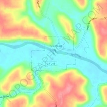
Name: Osterdock topographic map, elevation, terrain.
Location: Osterdock, Clayton County, Iowa, United States (42.72740 -91.16704 42.73628 -91.15182)
Average elevation: 745 ft
Minimum elevation: 620 ft
Maximum elevation: 922 ft
Clayton County trails, hiking, mountain biking, running and outdoor activities
Other topographic maps
Click on a map to view its topography, its elevation and its terrain.
Driftless Area National Wildlife Refuge - Fern Ridge Unit
United States > Iowa > Clayton County
Average elevation: 883 ft