
Make a donation
Gear up for your next adventure:
As an Amazon Associate, this site earns from qualifying purchases at no extra cost to you.
Wurzelberg topographic map
Click on the map to display elevation.
Make a donation
Gear up for your next adventure:
As an Amazon Associate, this site earns from qualifying purchases at no extra cost to you.
About this map
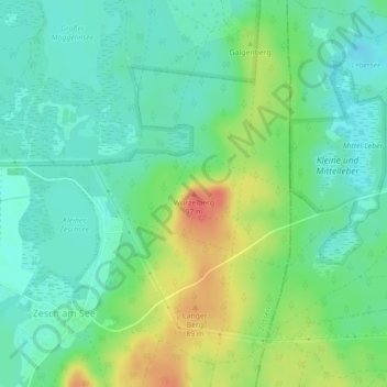
Name: Wurzelberg topographic map, elevation, terrain.
Location: Wurzelberg, Zossen, Teltow-Fläming, Brandenburg, Deutschland (52.12317 13.53823 52.12327 13.53833)
Average elevation: 177 ft
Minimum elevation: 115 ft
Maximum elevation: 299 ft
Make a donation
Gear up for your next adventure:
As an Amazon Associate, this site earns from qualifying purchases at no extra cost to you.
Other topographic maps
Click on a map to view its topography, its elevation and its terrain.
Schloss Zossen
Deutschland > Brandenburg > Teltow-Fläming > Zossen > Finkenherd
Die Schlossanlage entstand im 13. Jahrhundert auf einer kleinen Anhöhe als Wasserburg vermutlich auf einem ehemaligen slawischen Burgwall als markgräflich-meißnerische Grenzfeste. Zossen gehörte vor 1349 der Familie zu Torgau (Towgow), deren Besitz von Karl IV. bestätigt worden war. Die Burg stellte dabei…
Average elevation: 125 ft
Make a donation
Gear up for your next adventure:
As an Amazon Associate, this site earns from qualifying purchases at no extra cost to you.