
Good Thunder topographic map
Click on the map to display elevation.
About this map
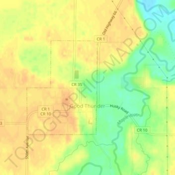
Name: Good Thunder topographic map, elevation, terrain.
Location: Good Thunder, Blue Earth County, Minnesota, United States (44.00024 -94.07886 44.01477 -94.06351)
Average elevation: 988 ft
Minimum elevation: 919 ft
Maximum elevation: 1,020 ft
Blue Earth County trails, hiking, mountain biking, running and outdoor activities
Other topographic maps
Click on a map to view its topography, its elevation and its terrain.
Lime Valley Mobile Home Park
United States > Minnesota > Blue Earth County > Mankato
Average elevation: 902 ft