
Thank you for supporting this site ❤️
Make a donation
Make a donation
Gear up for your next adventure:
As an Amazon Associate, this site earns from qualifying purchases at no extra cost to you.
Kingakati topographic map
Click on the map to display elevation.
Thank you for supporting this site ❤️
Make a donation
Make a donation
Gear up for your next adventure:
As an Amazon Associate, this site earns from qualifying purchases at no extra cost to you.
About this map
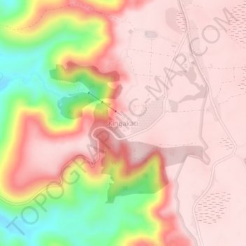
Name: Kingakati topographic map, elevation, terrain.
Location: Kingakati, Maluku, Kinshasa, République démocratique du Congo (-4.37456 15.72427 -4.33456 15.76427)
Average elevation: 1,959 ft
Minimum elevation: 1,119 ft
Maximum elevation: 2,316 ft
Thank you for supporting this site ❤️
Make a donation
Make a donation
Gear up for your next adventure:
As an Amazon Associate, this site earns from qualifying purchases at no extra cost to you.