Geolocate

Piel topographic map

Click on the map to display elevation.

About this map

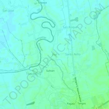
Name: Piel topographic map, elevation, terrain.

Location: Piel, Baliwag, Bulacan, Central Luzon, 3006, Philippines (14.96610 120.86585 15.00610 120.90585)

Average elevation: 43 ft

Minimum elevation: 30 ft

Maximum elevation: 62 ft

Other topographic maps

Click on a map to view its topography, its elevation and its terrain.

Tangos

Philippines > Bulacan > Baliwag

Average elevation: 49 ft

Gear up for your next adventure:

🚑Emergency Bivvies - Heat-reflective sleeping bags for survival situations
🎁Geography Themed Gifts - Unique gift ideas for map lovers and geography enthusiasts
🏔️Mountain Trail Maps - High‑detail maps for popular peaks
Camping Coffee Makers - Enjoy premium coffee at the summit or campsite
👟Trail Running Shoes - Lightweight shoes for trail runners

As an Amazon Associate, this site earns from qualifying purchases at no extra cost to you.