
Odemira topographic map
Interactive map
Click on the map to display elevation.
About this map
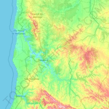
Name: Odemira topographic map, elevation, terrain.
Location: Odemira, Beja, Alentejo, Portugal (37.37372 -8.81953 37.87091 -8.31187)
Average elevation: 341 ft
Minimum elevation: -13 ft
Maximum elevation: 1,631 ft
Other topographic maps
Click on a map to view its topography, its elevation and its terrain.