Geolocate

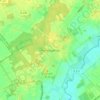
Sustrum topographic map

Click on the map to display elevation.

About this map

Name: Sustrum topographic map, elevation, terrain.

Location: Sustrum, Samtgemeinde Lathen, Landkreis Emsland, Nedersaksen, Duitsland (52.87976 7.12007 52.92319 7.31313)

Average elevation: 33 ft

Minimum elevation: 7 ft

Maximum elevation: 72 ft

Other topographic maps

Click on a map to view its topography, its elevation and its terrain.
Sustrum-Moor

Duitsland > Nedersaksen > Landkreis Emsland

Average elevation: 36 ft

Gleesen

Duitsland > Nedersaksen > Landkreis Emsland

Average elevation: 95 ft

Neusustrum

Duitsland > Nedersaksen > Landkreis Emsland

Average elevation: 36 ft

Hesselte

Duitsland > Nedersaksen > Landkreis Emsland > Emsbüren

Average elevation: 102 ft

Baccum

Duitsland > Nedersaksen > Landkreis Emsland > Lingen (Ems)

Average elevation: 138 ft

Ramsel

Duitsland > Nedersaksen > Landkreis Emsland > Lingen (Ems)

Average elevation: 128 ft

Sprakel

Duitsland > Nedersaksen > Landkreis Emsland > Stavern

Average elevation: 128 ft

Sand

Duitsland > Nedersaksen > Landkreis Emsland > Oberlangen

Average elevation: 33 ft

Haar

Duitsland > Nedersaksen > Landkreis Emsland > Haren (Ems)

Average elevation: 49 ft

Gear up for your next adventure:

🦶Carbon Trekking Poles - Reduce knee impact on steep descents with ultra-light poles
🗺️NatGeo Topo Maps - High-quality waterproof printed topographic maps of US Parks
🧭Outdoor Navigation Book - Learn advanced navigation skills
🧤Tactile Hiking Gloves - Keep hands warm while operating GPS and smartphone screens
🔥Plasma Lighters - Windproof lighters that work in any weather condition

As an Amazon Associate, this site earns from qualifying purchases at no extra cost to you.