
Thank you for supporting this site ❤️
Make a donation
Make a donation
Gear up for your next adventure:
As an Amazon Associate, this site earns from qualifying purchases at no extra cost to you.
Alles topographic map
Click on the map to display elevation.
Thank you for supporting this site ❤️
Make a donation
Make a donation
Gear up for your next adventure:
As an Amazon Associate, this site earns from qualifying purchases at no extra cost to you.
About this map
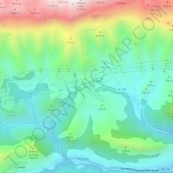
Name: Alles topographic map, elevation, terrain.
Location: Alles, Peñamellera Alta, Asturies, 33578, Espagne (43.31454 -4.72703 43.35454 -4.68703)
Average elevation: 1,276 ft
Minimum elevation: 190 ft
Maximum elevation: 3,809 ft
Thank you for supporting this site ❤️
Make a donation
Make a donation
Gear up for your next adventure:
As an Amazon Associate, this site earns from qualifying purchases at no extra cost to you.