
Thank you for supporting this site ❤️
Make a donation
Make a donation
Gear up for your next adventure:
As an Amazon Associate, this site earns from qualifying purchases at no extra cost to you.
Southport topographic map
Click on the map to display elevation.
Thank you for supporting this site ❤️
Make a donation
Make a donation
Gear up for your next adventure:
As an Amazon Associate, this site earns from qualifying purchases at no extra cost to you.
About this map
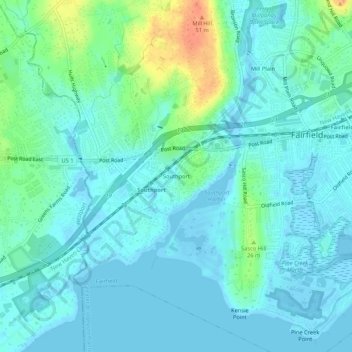
Name: Southport topographic map, elevation, terrain.
Location: Southport, Fairfield, Connecticut, 06890, United States (41.11649 -73.30345 41.15649 -73.26345)
Average elevation: 36 ft
Minimum elevation: -33 ft
Maximum elevation: 171 ft
Greater Bridgeport Planning Region trails, hiking, mountain biking, running and outdoor activities
Thank you for supporting this site ❤️
Make a donation
Make a donation
Gear up for your next adventure:
As an Amazon Associate, this site earns from qualifying purchases at no extra cost to you.