Geolocate

Goesan-eup topographic map

Click on the map to display elevation.

About this map

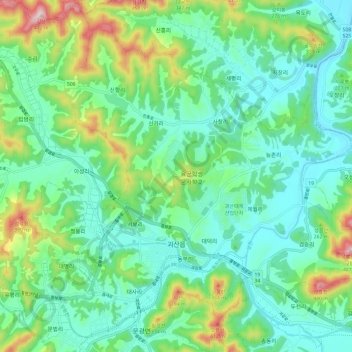
Name: Goesan-eup topographic map, elevation, terrain.

Location: Goesan-eup, Goesan-gun, North Chungcheong, South Korea (36.79061 127.74583 36.87151 127.86452)

Average elevation: 597 ft

Minimum elevation: 279 ft

Maximum elevation: 1,503 ft

Gear up for your next adventure:

🧭Pro Hiking Compasses - High-accuracy liquid-filled compasses for topographic orientation
🗺️Topographic Maps - Detailed topo maps for hiking, exploring and outdoor navigation
🪶Camping Sleeping Pad - Comfortable sleeping pad for backpacking
🪶Camp Gear Gift Set - Perfect gift bundle for outdoor fans
👟Trail Running Shoes - Lightweight shoes for trail runners

As an Amazon Associate, this site earns from qualifying purchases at no extra cost to you.