
Thank you for supporting this site ❤️
Make a donation
Make a donation
Gear up for your next adventure:
As an Amazon Associate, this site earns from qualifying purchases at no extra cost to you.
Alban topographic map
Click on the map to display elevation.
Thank you for supporting this site ❤️
Make a donation
Make a donation
Gear up for your next adventure:
As an Amazon Associate, this site earns from qualifying purchases at no extra cost to you.
About this map
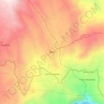
Name: Alban topographic map, elevation, terrain.
Location: Alban, Túquerres, La Sabana, Nariño, RAP Pacífico, Colombia (1.07151 -77.59268 1.11151 -77.55268)
Average elevation: 9,587 ft
Minimum elevation: 7,992 ft
Maximum elevation: 10,554 ft
Thank you for supporting this site ❤️
Make a donation
Make a donation
Gear up for your next adventure:
As an Amazon Associate, this site earns from qualifying purchases at no extra cost to you.